Ed Hillary Hope Reserve
Location
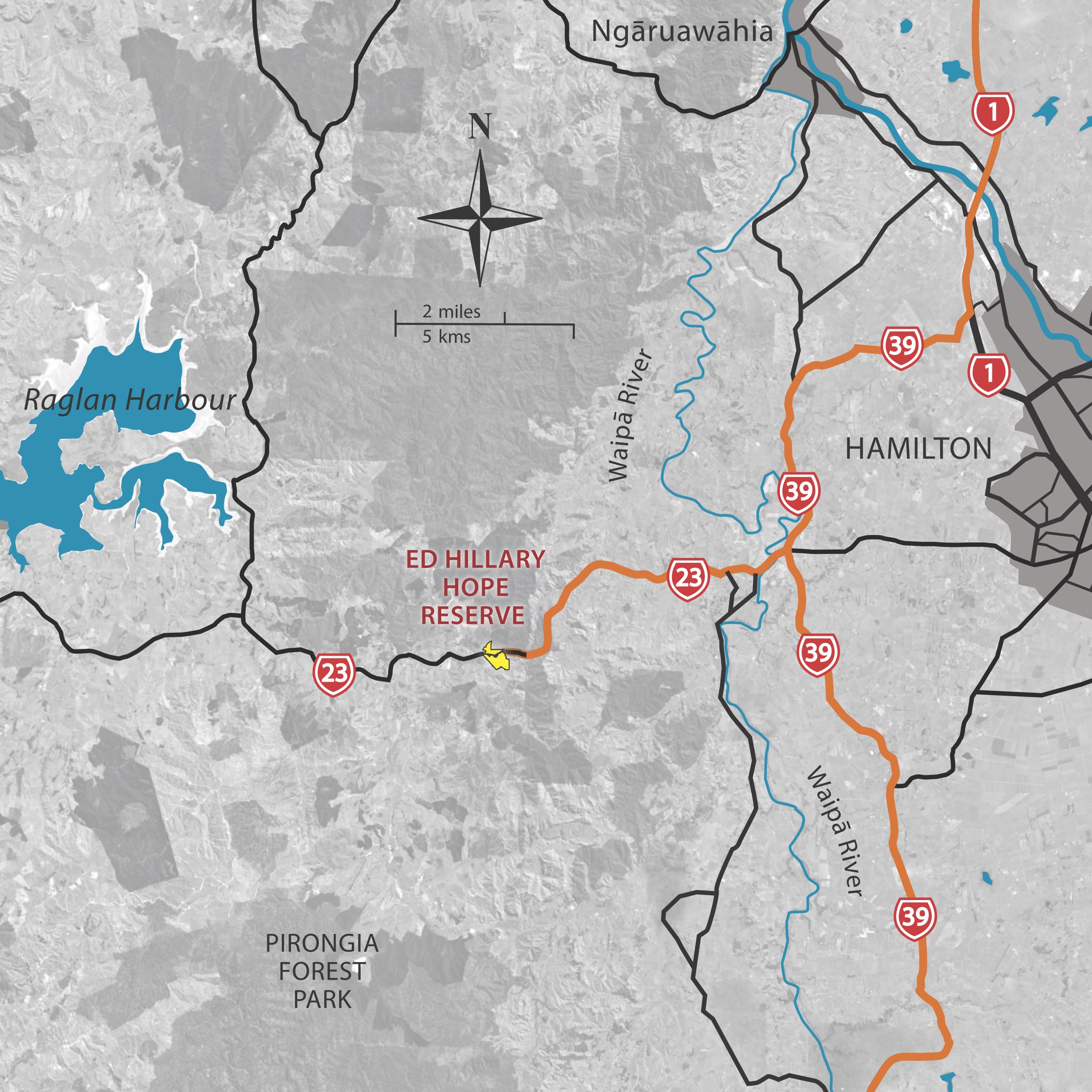
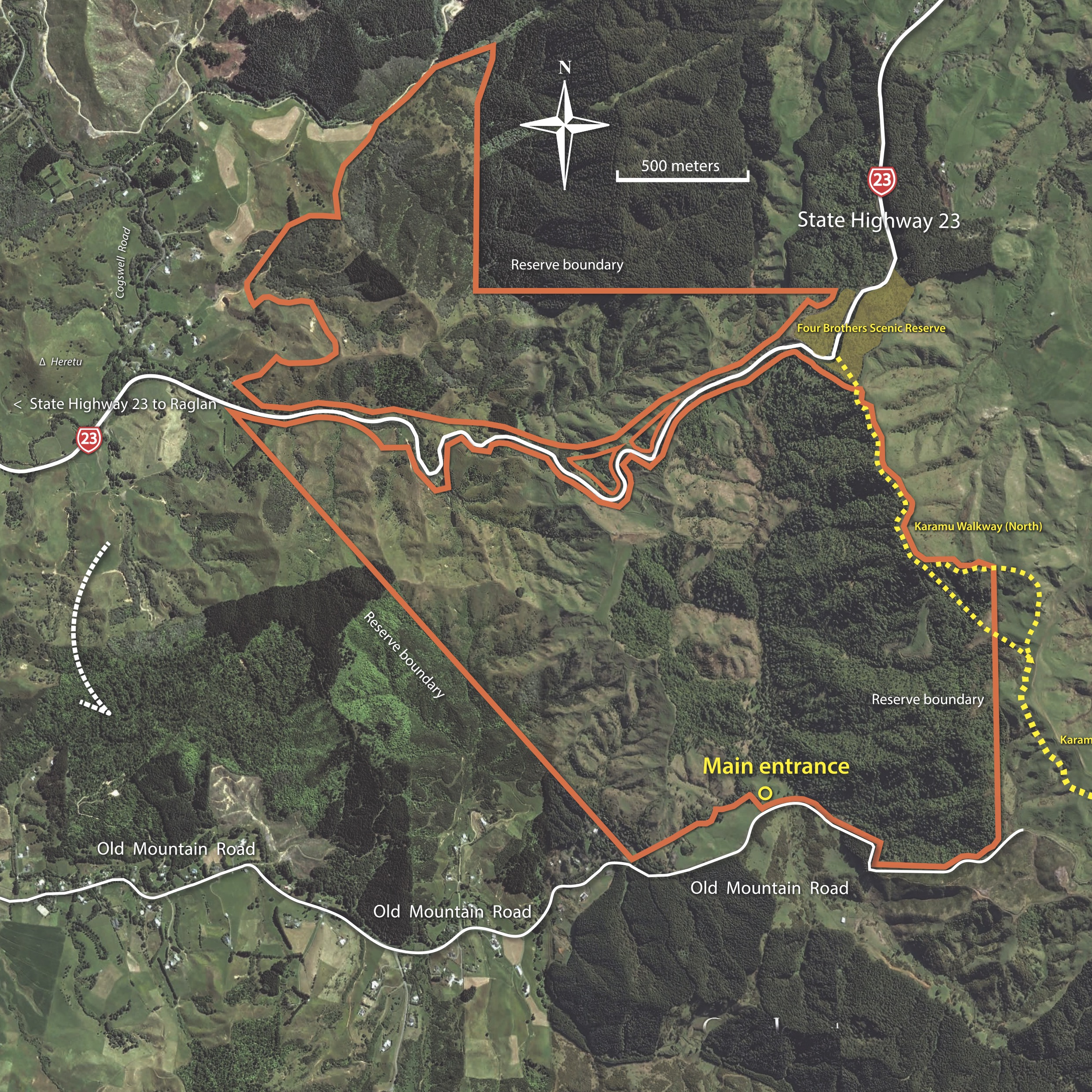
The reserve adjoins the Four Brothers Scenic Reserve (and the Karamu Walkway), midway between Hamilton and Raglan on SH23. The entrance is on Old Mountain Road (approximately 732 Old Mountain Road), Waitetuna.
Description
Purchased in 2014, this 460ha Reserve is named in recognition of Sir Edmund Hillary, Patron of the Native Forest Restoration Trust from 1980 to 2008, inspiring our nation for more than half a century and honouring his love for the natural environment.
The Hope family that owned this and other properties in the area is also recognised in the Reserve name, having made a significant contribution to the conservation of native forest and fauna on this Reserve and in the Waikato region.
The reserve is part of the Hamilton “Halo Project” which aims to bring native birds such as tūī and korimako (bellbird) back into Hamilton City, this Reserve supports those and many other native bush birds. The “Halo” is a 20km radius ring drawn around Hamilton, taking in key sites where tūī breed. This is how far tūī will fly to feed.
Forming part of the upper catchment of the Mangakirikiri Stream, restoring forest cover to the steep, erosion prone land in this Reserve will prevent erosion and siltation affecting the water quality of Raglan Harbour. In turn this will improve habitat for our native eels, whitebait, other Galaxias species, and many other harbour dwelling fish.
Removal of stock and goats has helped eliminate forest understorey browse and trampling and increased seedling survival. Possum, rat and mustelid control has already reduced their adverse effect on birdlife, invertebrates and the quantity of seeds available for regeneration. Areas of retired farmland are being planted with the help of volunteers.
Trust supporters and Waikato Regional Council enabled this purchase.
Flora and Fauna
In the past, timber was extracted from the forest and pasture created. Now diverse regeneration, dominated by tawa, tōtara, tānekaha, rimu, rewarewa, kohekohe and kāmahi is taking place, with kānuka and shrubs naturally recolonising retired grassland. On stream margins, kahikatea and pukatea the lovers of wet ground, form above-ground buttressed and fluted roots for stability.
Kererū or New Zealand pigeon congregate here in large numbers in late summer to feed on the fruit of tawa and miro. Kereru are important dispersers of these large, hard seeds. Tūī and korimako take nectar and insects from the numerous flowering scarlet and pink rātā vines and smaller fruit from other native trees and shrubs. Pīwakawaka (fantail) and riroriro (grey warbler) are numerous throughout mature and regenerating forest areas.
The small and endangered pekapeka-tou-roa (New Zealand long tailed bat) that roosts in tree cavities and emerges at dusk to feed, may also be present.
Walking Tracks & Facilities
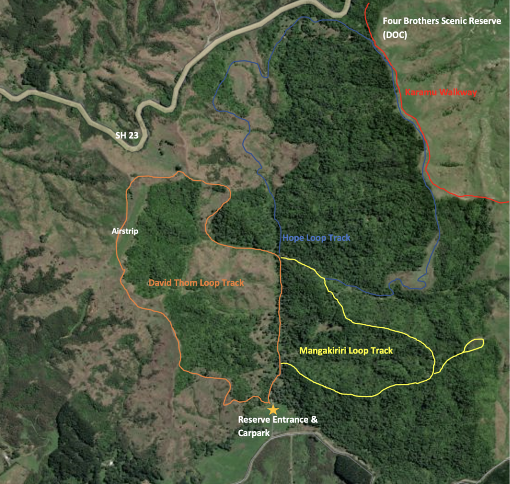
The Karamu Walkway runs through the Department of Conservation Four Brothers’ Reserve along the eastern boundary. Tracks begin at the main entrance off Old Mountain Road. Tracks are clearly signed and easy to follow from the small carpark and picnic area at the main entrance. There is a toilet through the entrance gate towards the track start.
Please keep to the tracks to avoid trampling vegetation or getting lost. Take reasonable care. Some portions of track can be slippery after rain and some sections are steep and uneven. Everyone is welcome to visit our reserves, at your own risk. Before you go into the outdoors, tell someone your plans and leave a date for them to raise the alarm if you haven’t returned.
No dogs are allowed in this wildlife reserve
No hunting without the express permission of the Native Forest Restoration Trust
DAVID THOM LOOP TRACK – closed for upgrade 22 April to 9 May 2025
Description: Intermediate track generally well formed with some steep sections that may be rough or slippery.
Time: 2 hours
Footwear required: Light tramping/hiking boots.
Marked with ORANGE coloured triangles.
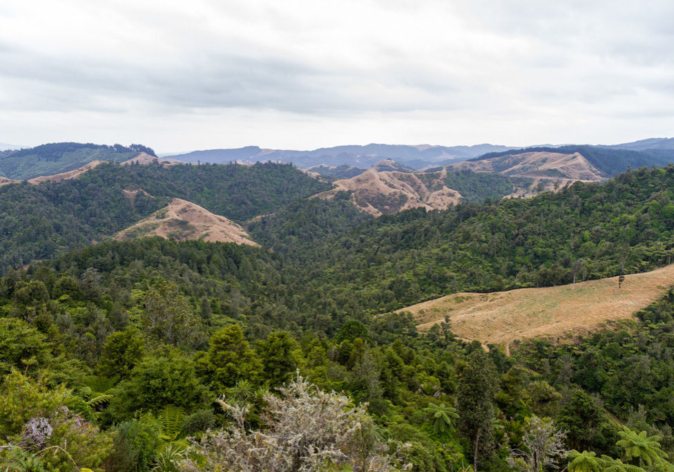
Good views of retired pasture and abundant natural regeneration. From high up on the airstrip, huge views of the windfarm, towards Raglan, Pirongia and Karioi. Plenty of grassy picnic places. Good birdlife.
NOTE the airstrip is occasionally used during summer. When this is the case, warning notices will be placed at airstrip approaches and pedestrian entry is prohibited. You are required to turn around and retrace your steps.
Markers of other colours may be present but these indicate biodiversity work areas and are not walking tracks.
VALLEY WALK
Description: Easy well formed track suitable for children and in wet weather.
Time: 30 minutes return.
Footwear required: Walking shoes.
Marked with ORANGE coloured triangles and part of David Thom Loop Track.
Good views of retired pasture and abundant natural regeneration alongside the track and in pockets in the grassland. Good birdlife.
Follow the vehicle track north for 15 minutes. At the T junction where the blue track joins on the right turn around and retrace your steps back to the carpark.
Markers of other colours may be present but these indicate biodiversity work areas and are not walking tracks.
MANGAKIRIKIRI LOOP TRACK
Description: Intermediate-Advanced track with some rough, slippery and very steep sections.
Time: 1.5 hours
Footwear required: Light tramping/hiking boots.
Marked with YELLOW coloured triangles.
Follows dry ridgelines often under a canopy of regenerating Tanekaha (celery pine) trees and in other places through lower vegetation. Some good views over forested areas of the reserve. There is an optional 15 minute loop at the highest point of the track that provides additional viewpoints.
Markers of other colours may be present but these indicate biodiversity work areas and are not walking tracks.
HOPE LOOP TRACK – section below SH23 closed till mid May 2025
This track is closed annually over the lambing season (approx. 1 August – 31 October).
Description: Advanced track with numerous very steep, rough, slippery sections.
Time: 3 hours
Footwear required: Hiking boots.
Marked with BLUE coloured triangles.
Climbs up to reach the Karamu Walkway and runs parallel to a section of that track for 20 minutes. Also adjacent to the Four Brothers Reserve with access to SH23. Vast views to the Waikato, the windfarm, Raglan, Pirongia and Karioi and over a large area of the reserve.
Markers of other colours may be present but these indicate biodiversity work areas and are not walking tracks.
Getting There
Get directions: Find out here
