Rangitoto Station
 Location
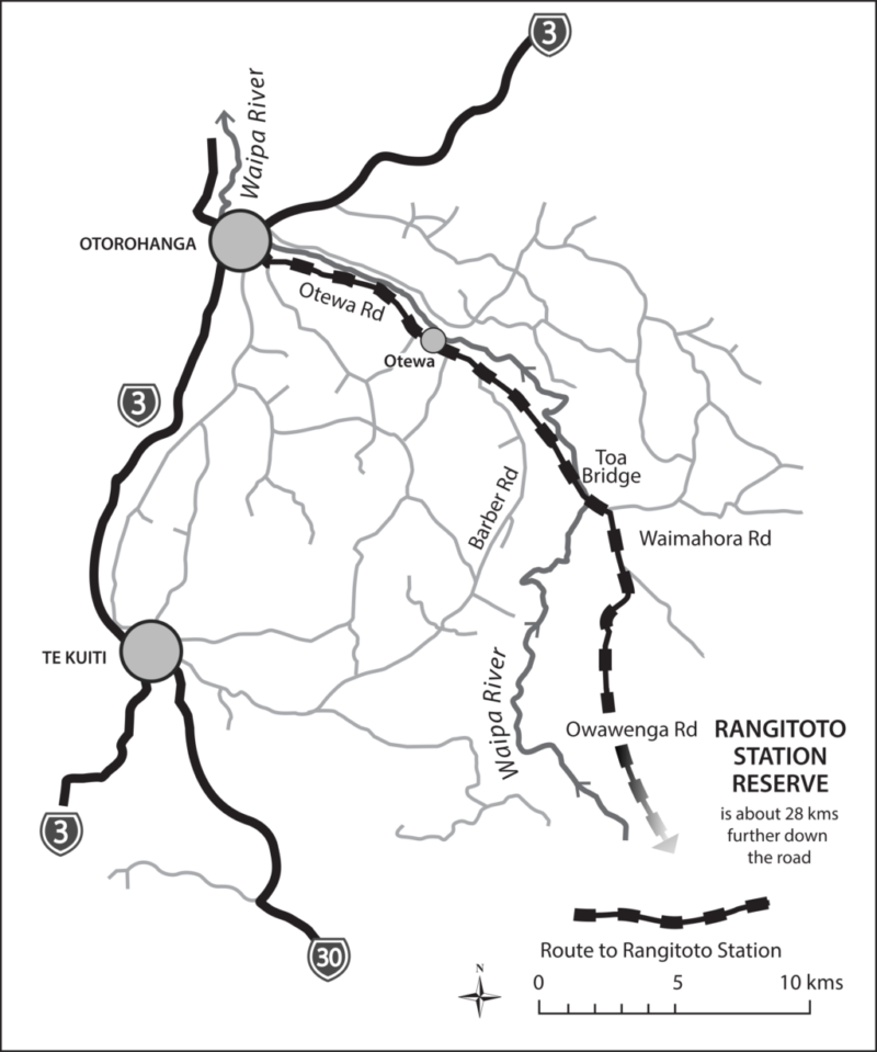
Rangitoto Station Reserve lies high up on the Rangitoto Range in the King Country, south-east of Otorohanga. It is a 427ha block of regenerating bush surrounded on all sides by protected mature forest, including Pureora Forest Park, private reserves and Maori Trust land.
History
Successive owners of the station tried to develop the land for farming for over eighty years, but due to its high altitude (600-850m) the growing season for grass was too short to sustain stock all year round. Only as a wild deer capture and farming venture did it succeed, until TB infection in the deer reduced its viability. Meanwhile the greater part of the land quietly reverted into scrubland and forest.
Vegetation
Eighty percent of the land is now well covered with regenerating bush. Much is still scrubby but there are more mature trees in the gullies and about 50ha of virtually untouched forest with some large original rimu trees. Most of the open pasture is close to the house and includes several swampy areas. This area has been intensively planted by volunteers and is rapidly changing.
The mature forest is a tawa and mixed podocarp canopy with ferns, tree ferns and supple-jack below. The regenerating gullies have tree fuchsia, ferns, wineberry and bushlawyer. Higher up are horopito, Hall’s totara and the mountain cabbage tree. The roadside banks are home to many orchids. The planted areas are mostly manuka, flax, cabbage trees and selected areas of podocarps and tree fuchsia.
Wildlife
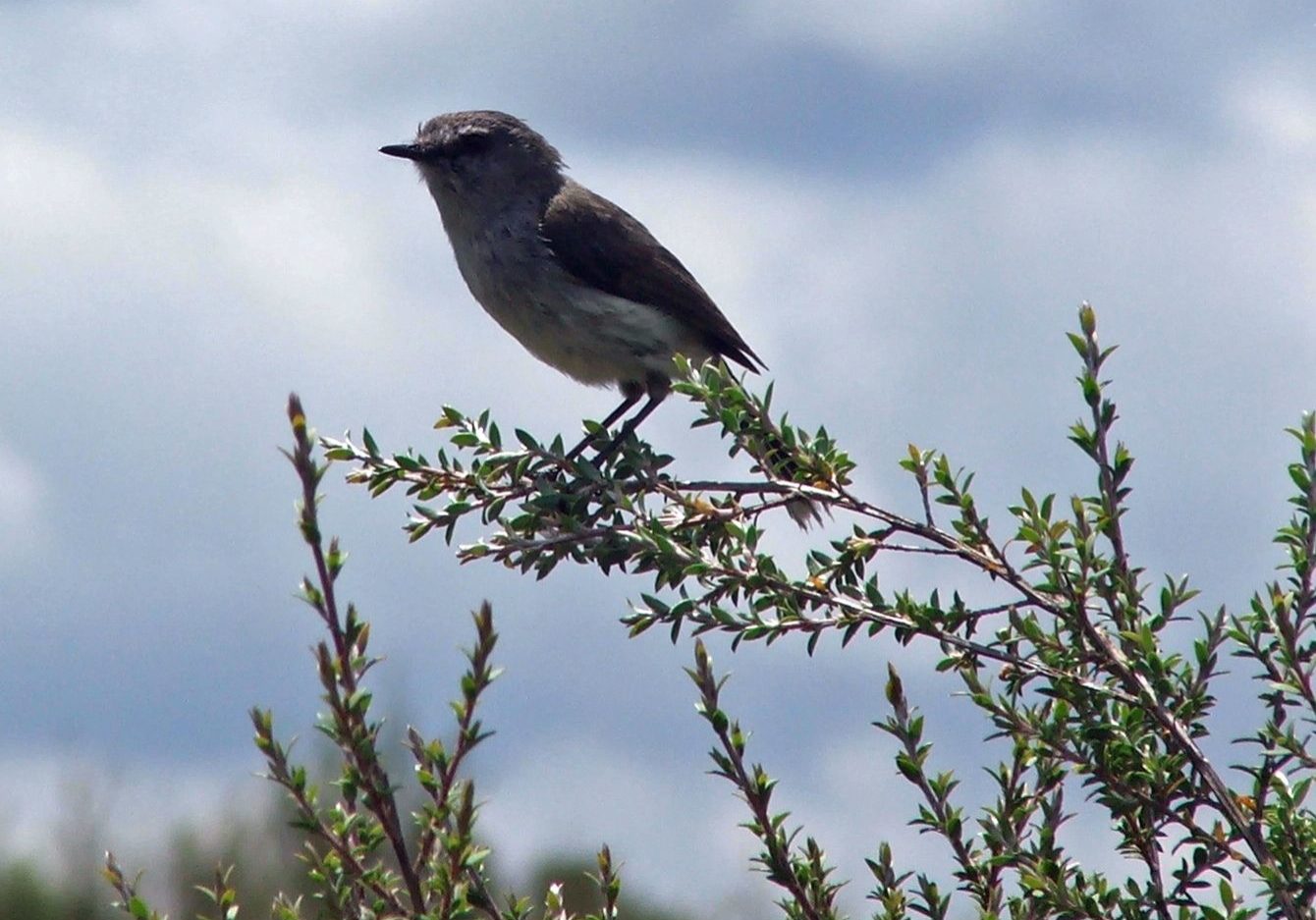
Birds that favour open shrubland are common such as the pipit, Australasian harrier, welcome swallow, paradise shelduck, whitehead and silvereye. With so much mature forest nearby, the forest birds are gradually moving in – the tui, bellbird, kereru, NZ falcon, pied tit, grey warbler, NI robin and cuckoo. Eventually it will become habitat for the kokako, kaka and kakariki.
There are also native bats and glow worms, Hochstetter’s frog lives in the surrounding areas. No surveys have been made on insect life.
Special Values
As the station is surrounded by mature and regenerating forest the value of filling in the last piece to complete the forest cover is high. Protection of an area like this lessens the chance of invasion by weeds and pests, yet the access and house remaining from the farming operations is invaluable for restoration, research, predator control and recreation.Three major tributaries of the Waipa River originate on the station. Protection of these waterways is vital to the water quality further downstream. In 1958 Otorohanga and the surrounding farmland were badly flooded when the Waipa burst its banks, the water was laden with silt from cleared land further up the valley.
Facilities
A house and woolshed are all that remain from the farming days. Everything else was demolished or sold to raise funds for the reserve purchase. The house provides good accommodation for recreational visitors or tree planters and the farm roads have formed the basis for an excellent network of tracks right around the reserve.
![]() For more detailed information about the use of the house please click here.
For more detailed information about the use of the house please click here.
![]() For more detailed information about the walking tracks please click here.
For more detailed information about the walking tracks please click here.
Management
The reserve is fortunate to have minimal invasive weeds, though vigilance is required to prevent seeds coming in on spades, boots and road maintenance equipment.
 Animal pests are hares, rabbits, possums, red deer, goats, pigs, rodents and mustelids. Control programmes are in place. Please be aware of the possible presence of poisons and/or hunters. Ask when making enquiries or bookings. A mainland island project run in the nearby Mangatutu Ecological area with intensive trapping and poisoning of pests has resulted in a flourishing kokako population. Click here for more details.
Tree planting and restoration has been going ahead using local seed grown off site and transplanted.
No hunting without the express permission of the Native Forest Restoration Trust
How to Get There
A key is required, obtained when booking.
Starting from State Highway 3, south of the Waipa River bridge on the south edge of Otorohanga, turn into Otewa Road under the rail bridge. Follow Otewa Road for 20 km, at which point you cross the Toa Bridge. At the next intersection turn right into Waimahora Valley Road. After approx 2 km turn right into Owawenga Road. Stay on that road and at the Y junction where there is a large wooden sign reading “Rangitoto Lands” take the left branch which progressively becomes a more minor gravel road, winding through a farm and into forest. It is very approximately 20 km from here to the locked gate where you will use the key you have been given to access private land and Rangitoto Station. This gate must be kept locked. The road can be rough in places but is negotiable by 2WD vehicles. Entry is at your own risk.
